
As we progressed further south we noticed that the freeway was fenced in and, periodically, there was something like the following structure in the middle of the fence.

After discussing this, we think we have an explanation for what this is. If you have an insight into this, feel free to share with a comment here, and we'll describe what we think is happening in our next blog.
We drove to Millinokent, Maine, which is near Baxter State Park, home of Mt. Katahdin, the official finish of the AT (Appalachian Trail) that starts more than 2000 miles earlier in Georgia. Each year hundreds of aspiring hikers start the hike and head to Mt. Katahdin: not all finish. I wanted to see what the finish to their epic hike looked like.
The next morning I rose early and drove to the State Park. From the ranger station one could see Mt. Katahdin.
 |
| Not as impressive as some of our Sierra peaks. |
 |
| A falls about a mile from where I started hiking.
|
And now a digression about trail construction. I have learned a lot about trail construction from my mentor, Ray Ford. Appropriate grade, switchbacks on steeper hillsides, water bars and off-slopes for drainage, etc. Time to forget all of that.
First thing to realize is that the ground is, typically, much rockier here in the east. As a result any trail design that involved significant changes to the topography of the ground would be a substantial undertaking. So don't do it. Instead, find the longest outcropping of rocks coming down a slope and, voila, you have your trail. Yes, you might have some vegetation to cut back and maybe some rocks to move to make it possible to navigate your outcropping, but apart from that AND A FEW WHITE DABS OF PAINT TO MARK THE ROUTE, you have your "trail". Switchbacks?? Not a word with any meaning here.
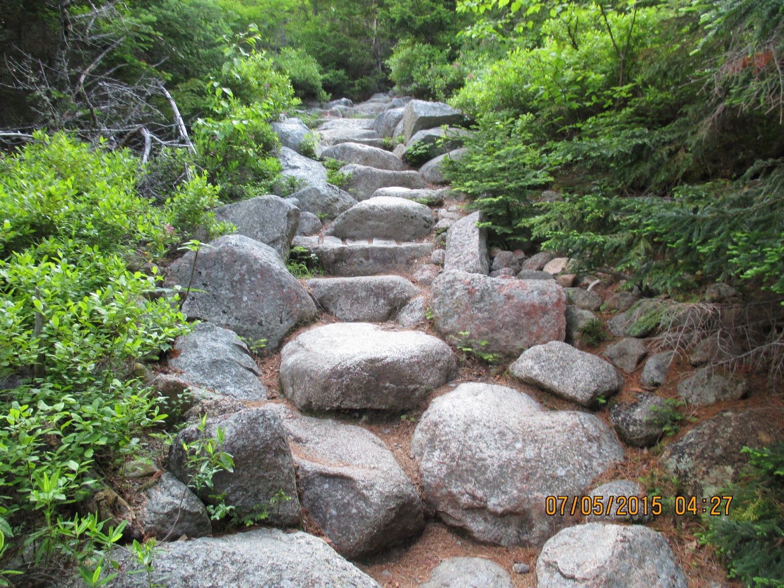
The above is a typical example of a trail so "constructed". Actually this is more benign than most of them. The end result is that these "trails" are relatively easy to design and maintain, but much harder to hike on.

Anyway, after several hours of "hiking" (more scrambling than hiking) here is the view of the summit. See any trails ahead? I didn't think so.

Getting closer there are relatively easy tablelands where the route is marked with cairns.

And this is the sign at the summit that the trail hikers have worked so many months to reach. And here is a view from the summit.

Time to turn around and head back down. This 11 mile round trip took all day and it wasn't easy. I'm grateful for our Western trail builders!
[Karen] Cough, cough, cough. Blow, blow, blow. Hack, hack, hack. - two days worth. Am sick in bed today with a bad cold!
No comments:
Post a Comment